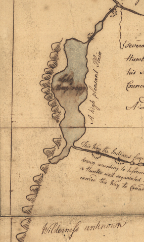
Samuel Langdon's 1756 Map (1)
|
Samuel Langdon's 1756 Map (1) |
| Langdon's 1756 Map of northern Vermont labels the area around the future town of Coventry a "Wilderness Unknown" |
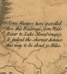 Abel Sawyer's 1784 Map (2) |
| As late as 1784 maps were still describing the area that would eventually become Coventry as a wilderness travelled only by hunters. |
|
References: 1. Library of Congress Geography and Map Division Washington, D.C. 20540-4650 USA 2. Library of Congress Geography and Map Division Washington, D.C. 20540-4650 USA |